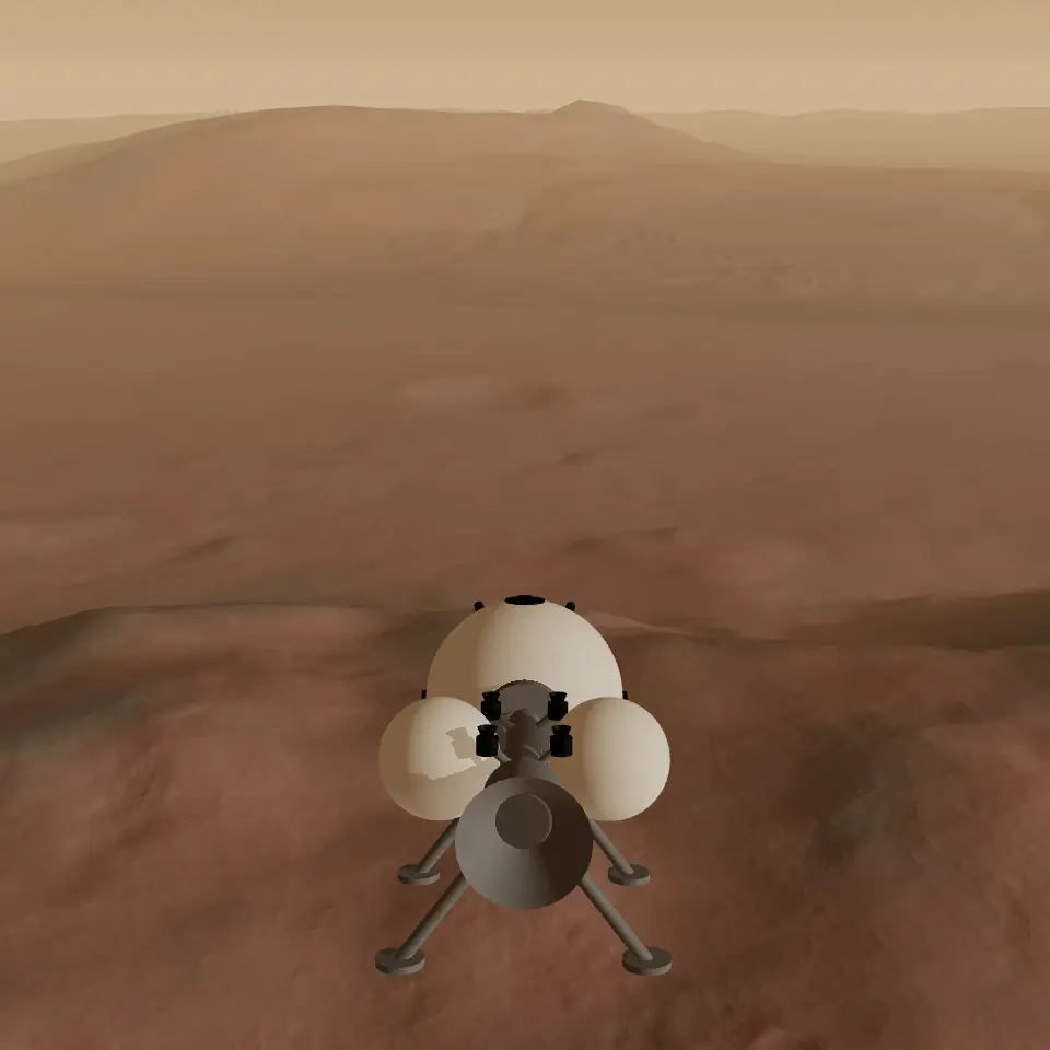
Fly a lander over Gale crater and Mount Sharp, built from real Mars orbiter data, and land beside the Curiosity rover.
Gale is a crater about 154 km across, just south of Mars’s equator, with a mountain of layered rock in the middle: Mount Sharp. NASA’s Curiosity rover landed on the crater floor in August 2012, reached the foot of the mountain in 2014 and, as of 2026, was still climbing it.
The ground you fly over is the real crater, measured from orbit. Curiosity stands where NASA reported it on sol 5021 (21 September 2026), and the waypoints are six real places on or near its route, plus the top of Mount Sharp, the mountain it was climbing as of 2026.
How to play
- W / S
- Nose down / up
- A / D
- Yaw left / right
- Q / E
- Roll left / right
- Space
- Main engine
- B
- Reverse thrust
- Shift / C
- Thrust up / down
- R
- Toggle flight assist
- L
- Landing lights
- F
- Search light
- M
- Waypoint markers on / off
- Drag / Scroll
- Look around / zoom
- V / double-click
- Reset the view
- Esc
- Pause
Go deeper: Gale and Mount Sharp ▾
Where Mount Sharp stands, there was once a basin that was sometimes filled by long-lived lakes, and the mud that settled in them built the layered rock at the mountain’s base. Higher up, the layers show an overall change from a wet landscape to a drier one.
Mount Sharp, formally Aeolis Mons, rises about 5 km above the crater floor.
Go deeper: Curiosity ▾
Curiosity’s first drill sample, from Yellowknife Bay in 2013, showed that this part of Gale was once a wet place where microbes could have lived. In 2024 it cracked open a rock in the Gediz Vallis channel and found crystals of pure sulfur.
The rover is about 3 m long and 2.2 m tall to the top of its mast, about the size of a small SUV. In the game it is drawn simplified, from boxes and cylinders at those dimensions.
Go deeper: The data ▾
The wide view, about 200 × 200 km at roughly 98 m per pixel, is the HRSC elevation model from ESA’s Mars Express, coloured from orbital images. Around Curiosity, a 20 × 20 km square is sharper, at about 5 m per pixel, from the USGS merged elevation model and orthophotos built from Mars Reconnaissance Orbiter images.
The sharper square fades in once you are high above it or outside it, so the ground never jumps under you. Shadows are baked for one late-afternoon Sun, about 18° up. Below the data’s resolution, small craters and surface texture are generated.
Go deeper: What’s real here ▾
Real: the shape of the terrain, Curiosity’s position and heading (as of sol 5021, 21 September 2026), and the waypoints. The Peace Vallis fan and the Mount Sharp summit are positions worked out from published maps and the elevation data; their cards say how.
Not real: the lander is fictional, and the radio is a game. The sky’s colour, the haze and the shadow brightness were tuned by eye against Curiosity’s own photographs.
Sources & credits
- MSL Gale merged DEM and orthophoto mosaics (detail terrain and imagery) · Calef III, F. J., & Parker, T. (2016). MSL Gale Merged DEM and Orthophoto Mosaics. PDS Annex, U.S. Geological Survey. (NASA/JPL-Caltech, USGS Astrogeology Science Center.) · Public domain (USGS); the detail shade and colour, made with HRSC data, are CC BY-SA 3.0 IGO · Reprojected around Gale, resampled to about 4.9 m, heights relative to the crater floor, shadows baked; imagery toned to match the HRSC brightness
- HRSC digital terrain model (regional terrain) · ESA/DLR/FU Berlin, CC BY-SA 3.0 IGO (HRSC DTM; Gwinner et al. 2009, 2010) · CC BY-SA 3.0 IGO · Reprojected to an orthographic plane, resampled to about 98 m, heights relative to the crater floor, 16-bit encoded, shadows baked; the derived height, shade and colour files carry the same licence
- HRSC nadir images (regional brightness) · ESA/DLR/FU Berlin, CC BY-SA 3.0 IGO (HRSC nadir images, orbits 1916, 1927, 1938); colour from the Viking MDIM 2.1 colourised mosaic, NASA Ames / USGS · CC BY-SA 3.0 IGO (images); public domain (Viking MDIM 2.1) · Three strips mosaicked with their brightness matched, coloured from MDIM 2.1, resampled
- Curiosity’s position and route waypoints · NASA/JPL-Caltech · Public domain (NASA) · Curiosity as of sol 5021 (21 September 2026); converted to metres around Gale
- Place names · IAU / USGS Gazetteer of Planetary Nomenclature · Public domain (USGS)
- Peace Vallis fan position · Palucis, M. C., et al. (2014). The origin and evolution of the Peace Vallis fan system that drains to the Curiosity landing area, Gale Crater, Mars. JGR Planets 119. · Cited (journal article); the position is our estimate from it
- Mars colour map (distant globe) · Solar System Scope · CC BY 4.0
- Radio voices · Spoken by the eSpeak speech synthesiser · Generated with GPL-3.0 software
- Sound effects (all but the engine and the explosion) · Generated with SoX · Generated with GPL-2.0 software
- Engine and explosion sounds · Reused from Dino Dodge on this site (source not recorded) · Not recorded